From address to plan in three steps
PLOT runs in your browser. Free account, no card needed. Nothing to download or install, start. Most people draw their first paddock within fifteen minutes of landing on the homepage. Here's the path.
Apply for beta access1. Find your place
The homepage hero is a single search field. Start typing your address and the dropdown narrows in real time. PLOT searches a global address database first; if your address is rural and isn't found there, the request falls back to community-mapped sources, which are built on volunteer-contributed data and have much better rural coverage in most of the world.
Every result shows its country. "Maple Street, Calgary, AB, Canada" vs "Maple Street, Calgary, QLD, Australia". No more landing on the wrong continent because of a coincidence in town names.
Pick a result and the editor opens at your property centroid at zoom 17 . close enough to see existing buildings, driveways, dam outlines, and fence lines on the satellite imagery. From that moment you're drawing on the place you came to plan.
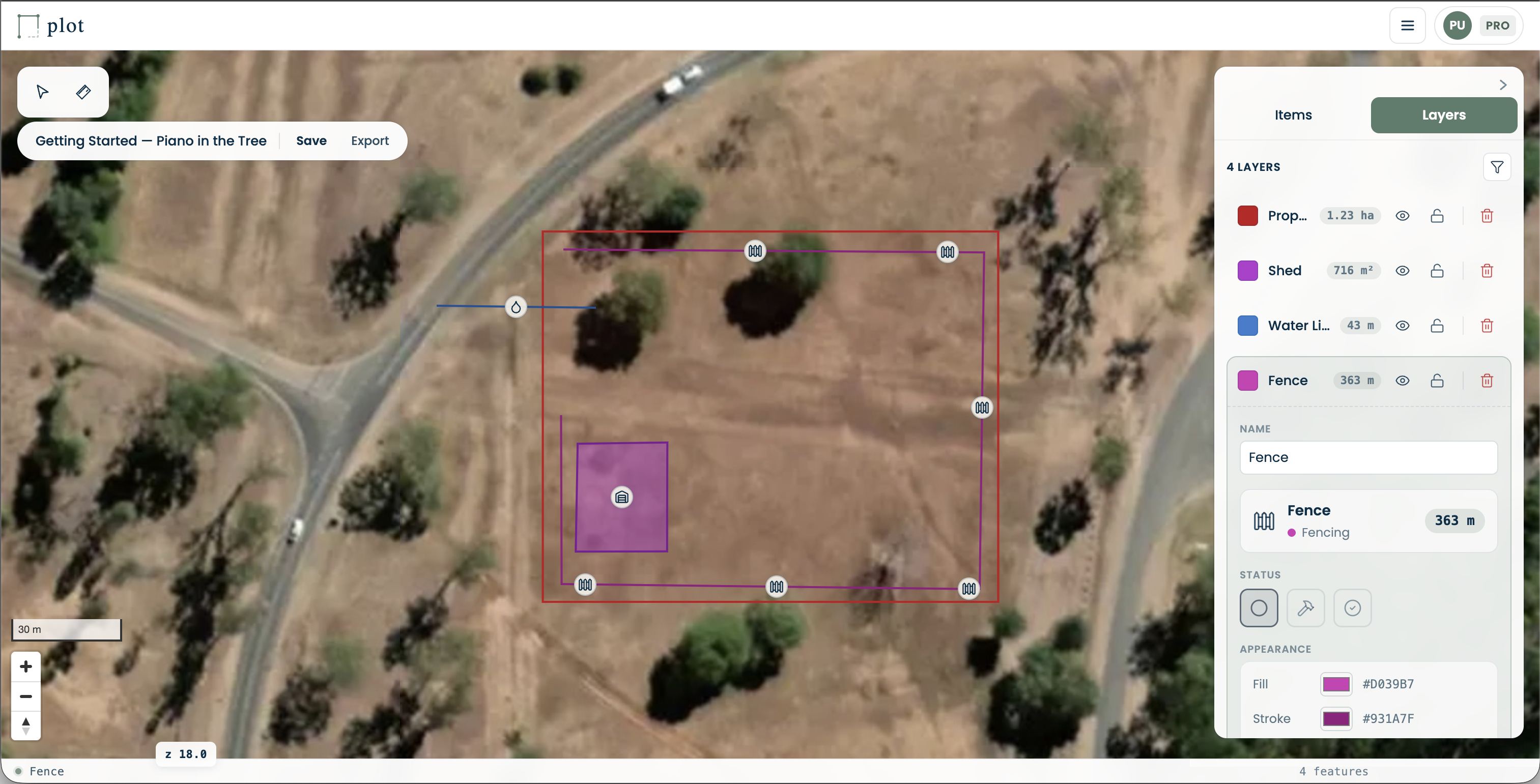
2. Draw your infrastructure
The left-hand panel is the item library. Pick a tool. paddock, fence, shed, dam, septic, drainage, power, water, or one of 25+ built-in types . and click to start drawing. Polygons take a click per vertex and a double-click to close. Lines take a click per vertex and double-click to finish. Points drop on a single click.
As you draw, the status bar at the bottom of the screen shows the live area or length in your preferred unit (acres + metres for Canada, hectares for metric-default countries, acres + feet for the US). The numbers count-settle when the shape closes so you can read the final value at a glance.
Undo and redo work as you'd expect. Ctrl/Cmd+Z and Ctrl/Cmd+Shift+Z, up to fifty steps. Every change auto-saves in your browser every half-second; if you're signed in it also syncs to your account, so open the same project on phone and laptop and you'll see a conflict warning rather than silently losing the older edit.
3. Save, share, or export
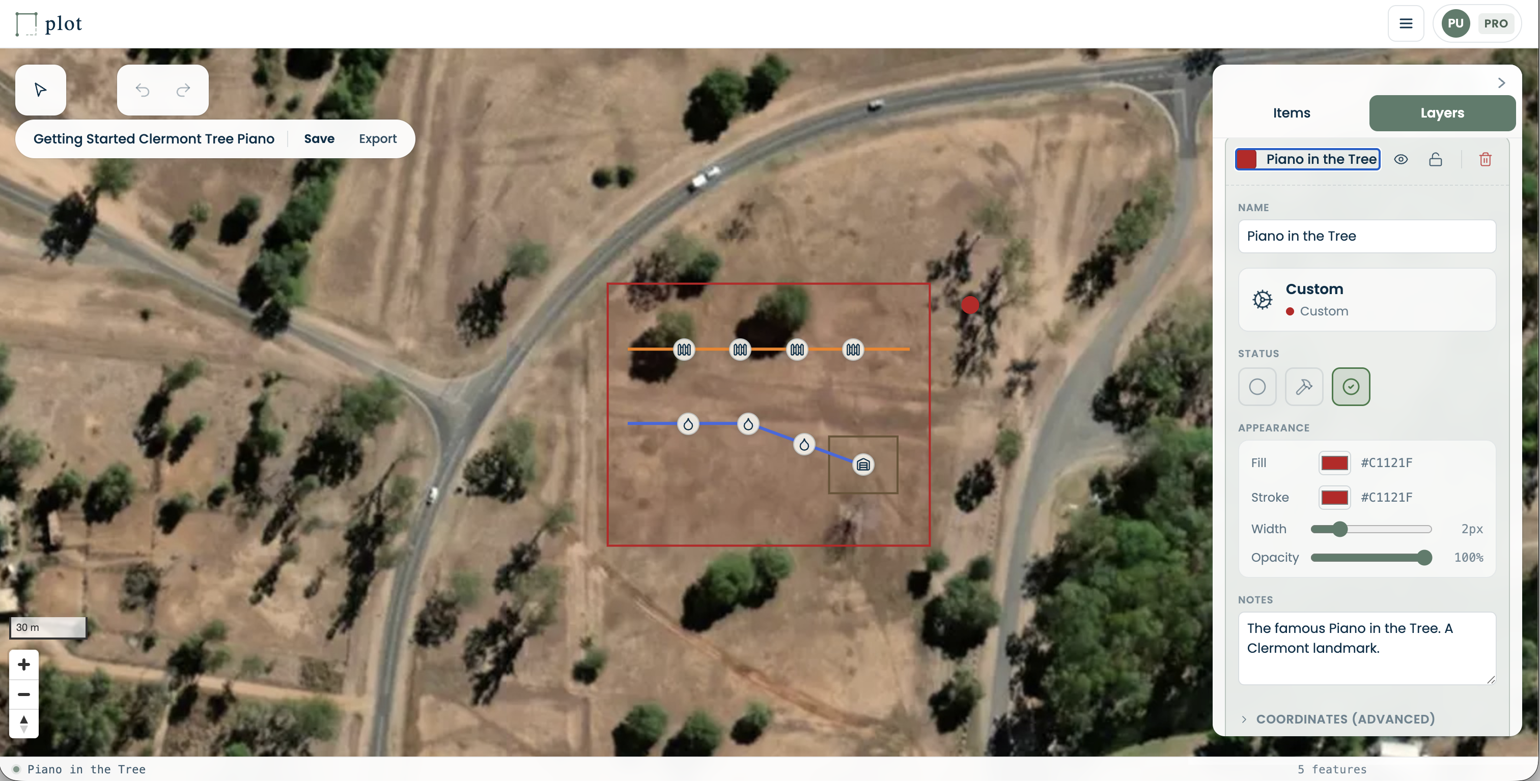
Every signed-in account gets cloud save against your account, so you can open the same project on any device and the most recent edits are already there. Projects also export to PDF and image via the export dialog, useful for handing your plan to a contractor or attaching it to a council submission.
Sharing is a Pro feature. From a Pro account you can invite anyone to a map via a private link. Recipients on a Pro account can edit alongside you; recipients on a Free account view the plan in read-only mode - every layer toggleable, every feature inspectable, but no drawing tools. Shares can be revoked at any time from the share modal.
Pro also raises the layer cap to 50 and raises the project ceiling to 20, and adds full version history and execution tracking (mark each item as planned, in-progress, or built). Pro+ removes the project limit entirely (unlimited projects and layers) and adds branded, embeddable shareable plans. Team adds shared team access: group projects into teams so a whole team can view and edit them together. Enterprise keeps all of that and adds white-label and per-deployment options.
Find your place.
Fifteen minutes from now you could have your first paddock drawn.
Apply for beta access